The Dual Route Structure: Ridge vs. Bedrock
Between Aurlandsvangen and Lærdalsøyri lies one of the most compelling infrastructure contrasts in Northern Europe. Travelers can choose between two completely disparate routes:
Above lies Aurlandsfjellet (County Road 243), known as Snøvegen (The Snow Road). This 47-kilometre single-lane road climbs from sea level at Aurlandsfjord to an elevation of 1,306 metres across a barren, wind-scoured permafrost plateau where snowdrifts regularly persist well into July.
Directly beneath lies the Lærdal Tunnel (E16). Opened in 2000, this 24.5-kilometre engineering masterpiece is the longest road tunnel on Earth. Designed to provide uninterrupted year-round winter connectivity between Oslo and Bergen, it features three subterranean caverns equipped with amber and soft gold lighting schemes designed to simulate sunrise, countering driver claustrophobia and optical fatigue.
Stegastein Viewpoint Architecture
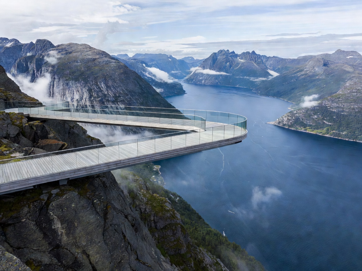
Ascending from Aurlandsvangen on the west side of the pass, the road first reaches Stegastein at 650 metres elevation. Designed by Saunders Architecture and Wilhelmsen Arkitektur, this 30-metre long, 4-metre wide structure is built from laminated pine and galvanized steel.
The platform cantilevers straight out from the mountain slope without external supports. At its terminus, an inclined frameless panel of structural glass tilts outward, creating an unimpeded vertical gaze directly into the fjord below. Stegastein remains accessible year-round from the Aurland side, as snowplows clear the roadway up to the platform even when the high plateau beyond is shuttered.
Plateau Driving Characteristics & Passing Protocol
Once past Stegastein, the roadway narrows to a single-lane asphalt strip with interspaced passing places (marked by blue signs bearing the letter 'M' for Møteplass).
- Passing Courtesy: The vehicle nearest an 'M' pocket must stop and wait to allow the oncoming vehicle to pass. Never cross onto unpaved shoulders, which are soft peat or sharp crushed stone.
- Summer Microclimate: Temperatures at the summit can drop from 22°C at fjord level to 2°C with dense freezing fog within a forty-minute climb.
- Livestock Encounters: Free-roaming sheep grazing near snowmelt streams frequently congregate on the sun-warmed road surface, demanding moderate cornering speeds.
Comparative Overview: Pass vs. Tunnel
| Attribute | Aurlandsfjellet (Fv243) | Lærdal Tunnel (E16) |
|---|---|---|
| Distance | 47 km | 24.5 km |
| Typical Drive Time | 1.5 to 2.5 hours | 20 minutes |
| Operating Window | June to October (Closed winter) | Open 24/7/365 |
| Scenery | Fjords, tundra, glaciers, snow banks | Illuminated rock caves, subterranean engineering |
| Gradient / Elevation | Up to 1,306 metres above sea level | Near level (sub-mountain gradient) |
Itinerary Recommendation: The Perfect Loop
A recommended itinerary for travelers based around Flåm or Aurland is the circular loop: ascend Aurlandsfjellet over the summit to Lærdalsøyri to explore its protected 18th-century wooden architecture, visit Borgund Stave Church (30 minutes further east on the E16), and return westbound to Aurland through the heart of the mountain via the Lærdal Tunnel.