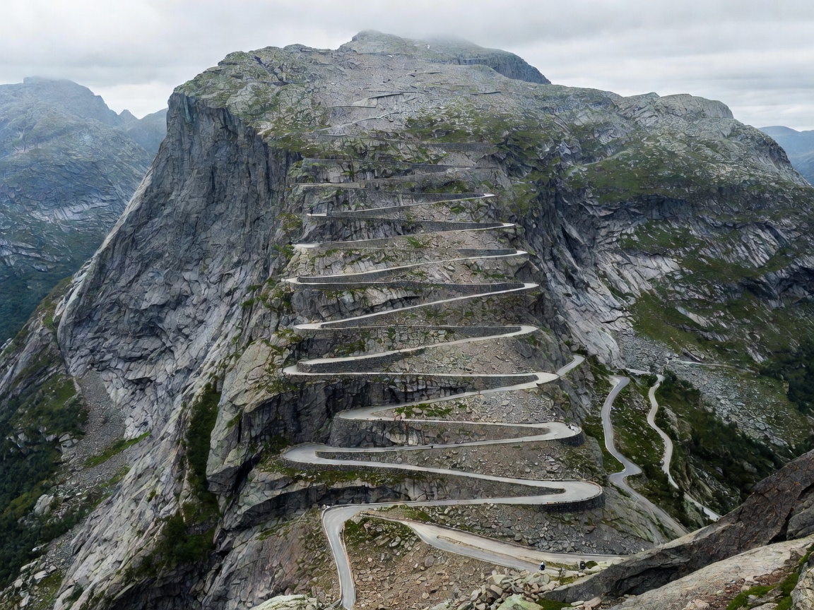
Engineering History and Alpine Profile
Opened in 1936 by King Haakon VII after eight years of manual blasting and dry-stone masonry, Trollstigen (the Troll’s Path) is one of Scandinavia’s most renowned mountain passages. Covering a distance of 104 kilometres from Langevatnet on Strynefjellet to Sogge Bru in Rauma, the route climbs up the Isterdalen valley wall through eleven consecutive 180-degree hairpin turns.
The roadway reaches a sustained gradient of approximately 10 percent (1:10), gaining over 800 metres of elevation from the valley floor to the plateau summit at 858 metres above sea level. Mid-way up the climb, the road crosses the roaring Stigfossen waterfall via an arched natural-stone bridge, where mist frequently blankets the carriage surface.
Geological Hazards & Operational Windows
Due to its sheer mountain walls rising over 1,000 metres above the asphalt (including the peaks of Bispen, Kongen, and Dronningen), Trollstigen is subject to heavy freeze-thaw cycles and rockfall risk.
- Opening Dates: Typically opens between late May and mid-June once heavy winter snowpack and hanging cornice risks are mitigated by the Norwegian Public Roads Administration.
- Closing Dates: Closes upon the first major autumn snowfall, usually between mid-October and early November.
- Vehicle Length Restrictions: Strict vehicle length restrictions are enforced at 13.1 metres. Vehicles exceeding this limit cannot clear the radiused hairpins without mounting oncoming lanes. Towing caravans requires high-torque vehicles with low-gear engine braking capability.
Architectural Highlights: The Plateau Center
At the crest of the pass sits the Trollstigen Visitor Centre, designed by Reiulf Ramstad Arkitekter. Constructed from cast-in-place concrete and untreated weathering steel, the building embeds itself seamlessly into the surrounding moraine landscape. Water channels divert glacier run-off through shallow reflecting pools surrounding the outdoor terraces.
From the centre, a cantilevering pathway of weathering steel mesh extends 200 metres out over the cliff edge, terminating at a viewing platform suspended hundreds of metres above the switchbacks and Isterdalen valley.
Driving Technique: Descent & Brake Fade Prevention
Descending Trollstigen or the adjacent Ørnevegen (Eagle Road) down into Geiranger places intense thermal stress on vehicle braking systems. Constant friction braking on a 10 percent continuous slope will boil brake fluid and cause catastrophic brake fade.
Operational Advisory: Shift manual and automatic transmissions into low fixed gear (Gear 1 or 2) before initiating the descent. Rely on engine compression braking to maintain a controlled descent speed of 25–35 km/h, utilizing wheel brakes only intermittently for hairpin deceleration.
Route Comparison: Trollstigen vs. Adjacent Passes
| Pass Name | Max Altitude | Max Gradient | Operating Window |
|---|---|---|---|
| Trollstigen (Fv63) | 858 m | 10.0% | Late May – October (Seasonal) |
| Ørnevegen (Eagle Road) | 620 m | 10.0% | Year-Round (Plowed winter route) |
| Gamle Strynefjellsvegen | 1,139 m | 9.0% | June – October (Seasonal gravel/tarmac) |